Using Map Fragments to Recreate Lost Treasure Paths
Using Map Fragments to Recreate Lost Treasure Paths
The age-old allure of treasure hunting is deeply ingrained in human culture. Throughout history, untold riches have been hidden in various locations, with maps serving as the primary means for seekers to find these buried fortunes. But, many of these maps have been lost or fragmented over time. In this article, we will explore the techniques and methodologies employed to piece together these map fragments to recreate paths to lost treasures. We will also discuss relevant examples and case studies that illustrate the principles and strategies of using map fragments in treasure hunting.
The Importance of Map Fragments
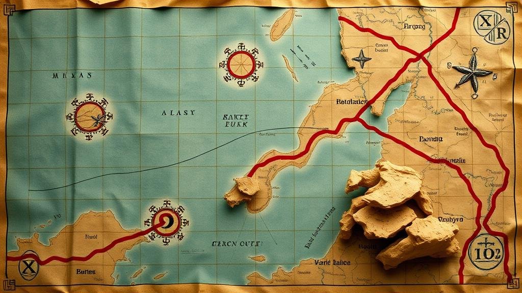
Map fragments are remnants of historical maps that have not survived in their entirety. They can be small sections of paper that contain critical details about land, topography, and previous ownership. Understanding how to interpret these fragments is essential because they can provide invaluable clues that lead to lost treasures. For example, treasure maps from the 18th and 19th centuries often include key landmarks, such as rivers, mountains, and old buildings, which were used as reference points.
A notable case is the treasure of Captain Kidd, a notorious pirate. The map that allegedly leads to his hidden treasure was found in fragments and included landmarks that were essential for locating the treasure. By analyzing the specifics of the landmarks depicted on the map, researchers were able to narrow down the search area significantly.
Techniques for Recreating Lost Treasure Paths
Recreating paths using map fragments is a meticulous process that involves various techniques, including georeferencing, digital reconstruction, and comparative analysis. Each method has its strengths and serves different purposes in the quest for lost treasures.
- Georeferencing: This technique involves aligning map fragments with modern geographical coordinates. By using geographic information systems (GIS), researchers can overlay historical maps on current topographies, allowing them to visualize changes over time.
- Digital Reconstruction: With advancements in technology, software can now help reconstruct fragmented maps digitally. This process utilizes artificial intelligence to predict and fill in missing parts based on historical data and surrounding context. For example, the software can approximate the shapes of the lost sections based on existing fragments.
- Comparative Analysis: This method involves comparing known historical maps with the fragments to identify similarities and differences. By piecing together information from various sources, researchers can enhance their understanding of the potential paths leading to the treasure.
Challenges and Considerations
Despite the advancements in technology, recreating lost paths using map fragments presents various challenges. One significant issue is the inaccuracies that can arise from misinterpretation of the fragments. For example, the material used in map creation may also decay over time, leading to tears or fading that obscure vital information.
Plus, treasure maps are often laden with cryptic symbols and codes that require specialized knowledge to decode. A famous instance of this is the Beale Ciphers, which are associated with a buried treasure in Virginia. Despite numerous attempts, only one of the three ciphers has been solved, showcasing the complexity often involved in interpreting these maps.
Real-World Applications
The techniques of using map fragments have been applied in various archaeological contexts beyond treasure hunting. For example, archaeologists studying ancient civilizations often rely on fragmentary maps to locate lost cities or trade routes. These applications illustrate the enduring importance of understanding historical geography and the role of mapping in cultural heritage.
One exemplary case is the exploration of the ruins of Pompeii. Researchers have used ancient maps and fragmented documents to help visualize how the city was structured before the catastrophic eruption of Mount Vesuvius. This information aids in restoration projects and enhances our understanding of Roman urban planning.
Conclusion and Actionable Takeaways
To wrap up, the process of using map fragments to recreate paths to lost treasures is a fascinating intersection of history, archaeology, and technology. By employing techniques such as georeferencing, digital reconstruction, and comparative analysis, researchers are uncovering new possibilities and reviving lost histories. But, it is crucial to approach this work with an understanding of the inherent challenges and complexities involved.
For treasure hunters, historians, and archaeologists alike, a few actionable takeaways include:
- Leverage modern technology–make use of GIS tools and digital archives to analyze and visualize map data.
- Engage with experts in cartography and history to provide insights that can aid the reconstruction process.
- Document findings comprehensively, as sharing successes and challenges can foster collaborative efforts in the pursuit of lost histories and treasures.


