Exploring Prehistoric Migration Maps from USGS for Fossil Sites
Exploring Prehistoric Migration Maps from USGS for Fossil Sites
The study of prehistoric migration and its correlation with fossil sites is a pivotal aspect of paleontology and archaeology. The United States Geological Survey (USGS) provides crucial data and maps that contribute to our understanding of these migrations. This article delves into the intricacies of these maps, examining their implications for fossil site discovery and prehistoric human behavior.
Understanding Prehistoric Migration
Prehistoric migration refers to the movement of human populations prior to the advent of written history. This movement was often influenced by environmental changes, resource availability, and climatic conditions. According to archaeological evidence, early humans migrated out of Africa approximately 60,000 years ago, spreading across the globe. The migration patterns of these groups can be traced through various fossil sites, identified through modern maps and geological surveys.
The Role of USGS in Mapping Migration Patterns
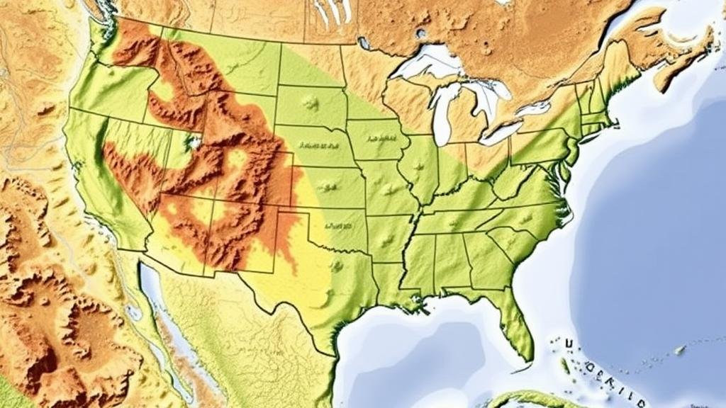
The USGS plays a vital role in documenting geological and paleontological data relevant to prehistoric migrations. By integrating geological maps with fossil locations, researchers gain comprehensive insights into past environments and human behaviors. The USGS provides various data sources, including:
- Topographic maps illustrating terrain and elevation.
- Geological maps detailing rock types and structures.
- Hydrological data showing ancient water sources.
These maps are instrumental in pinpointing fossil sites, revealing how ancient humans adapted to their surroundings during migration.
Case Studies of Fossil Sites
Several fossil sites in the United States illustrate the utility of USGS maps in understanding prehistoric migration. For example, the La Brea Tar Pits in Los Angeles, California, feature an exceptional record of ice age fauna, including saber-toothed cats and woolly mammoths. USGS geological maps help trace the shifting landscapes that influenced animal movement and predation patterns during the Late Pleistocene epoch.
Another significant site, the Blackwater Draw in New Mexico, is renowned for its paleoindian artifacts and remains of extinct megafauna. Excavations reveal that the site was periodically occupied around 13,000 years ago, coinciding with climatic changes documented in USGS datasets. The layered sedimentation revealed through geological mapping illustrates how early inhabitants adapted their migration routes based on resource availability.
The Importance of Geological Context
Understanding the geological context of fossil sites is essential for correctly interpreting archaeological findings. Geology can significantly influence migration patterns, as different terrains offer varying resources. For example, river valleys often serve as migration corridors due to the availability of water and food sources. The USGS provides detailed models to help researchers visualize these critical environments.
Also, data from the USGS highlights shifts in vegetation over millennia, which would have affected the types of animals early humans hunted. A study by the USGS indicated that climate fluctuations during the Holocene led to the expansion and contraction of forests, directly impacting the migration routes of both humans and megafauna.
Technological Innovations and Their Impact
Recent advancements in technology have transformed how researchers utilize USGS maps in their studies. Geographic Information Systems (GIS) allow for the analysis of spatial data, enabling researchers to overlay migration patterns with geological features effectively. This integration provides a more granular view of how prehistoric humans interacted with their environments.
For example, by employing GIS technology, researchers can visualize the relationship between fossil sites and ancient water courses, facilitating a deeper understanding of migration decisions made by prehistoric populations.
Conclusion and Future Directions
The exploration of prehistoric migration through USGS maps offers invaluable insights into human history. By studying how environmental factors influenced migration patterns and site selection, researchers can reconstruct ancient ecosystems and human behaviors. Future research should continue to integrate technological advancements with geological mapping to uncover more detailed aspects of prehistoric migrations.
As we look ahead, the collaboration between paleontologists, geologists, and archaeologists will be crucial in continuing to unravel the complexities of our past. The data provided by the USGS serves as a foundational resource for this interdisciplinary work.
Actionable Takeaways
- Use USGS maps to identify potential fossil sites based on geological and environmental history.
- Incorporate GIS technology to visualize and analyze migration patterns in relation to fossil locations.
- Engage in interdisciplinary research to build comprehensive models of prehistoric human behavior.


