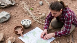
Detecting Along Forgotten Trails and Paths With Deep Soil Erosion Markers
Detecting Along Forgotten Trails and Paths With Deep Soil Erosion Markers
The study of forgotten trails and paths can provide significant insights into historical human activity, land use, and ecosystem dynamics. But, these old pathways often become obscured or altered due to natural and anthropogenic factors, such as vegetation growth and soil erosion. One innovative method to uncover these hidden pathways is through the analysis of deep soil erosion markers. This article delves into how deep soil erosion markers can function as indicators for detecting forgotten trails, exploring their biological, geological, and archaeological implications.
Understanding Deep Soil Erosion Markers
Soil erosion is a natural process where the top layer of soil is removed, often resulting in landscape changes. Deep soil erosion markers are specific signs that indicate historical soil loss due to various factors, including water runoff, human activity, and climatic conditions.
- Types of Erosion: There are three primary types of soil erosion: sheet erosion, rill erosion, and gully erosion. Each type leaves different markers in the landscape.
- Markers: Markers can include exposed root systems, varying soil texture, and layers of sediment that reveal a history of soil movement.
By studying these markers, researchers can deduce patterns of historic land use and travel. For example, a path that exhibited considerable erosion might indicate heavy foot traffic over time, signaling its importance in trade or transportation.
Applications in Archaeology and History
Detecting forgotten trails using deep soil erosion markers has profound implications in archaeology. By identifying these markers, archaeologists can trace the routes taken by ancient humans, potentially uncovering significant trade routes or migration pathways.
One notable example is the study of the ancient Inca Trail in Peru. Researchers have employed soil erosion markers to map the trails evolution over centuries, analyzing areas where deep erosion suggests historic usage patterns. Findings indicate that certain sections of the trail aligned closely with sites of habitation, hinting at socio-economic interactions between communities.
Ecological Impact and Considerations
The identification of forgotten trails also has ecological implications. Paths long abandoned may become vital for wildlife re-establishment and migration. Over time, these routes can transform into wildlife corridors, facilitating species movement and genetic exchange.
- Ecosystem Restoration: Understanding the historical use of these pathways can inform restoration efforts, making it possible to reconstruct landscapes conducive to local biodiversity.
- Invasive Species Management: Knowledge of old trails allows for better management strategies against invasive species which sometimes exploit these forgotten corridors.
Methodologies for Detection
Several methodologies can be employed to detect forgotten trails using deep soil erosion markers, including:
- Soil Sampling: Collecting soil samples at various depths provides data that can be analyzed for erosion history.
- Remote Sensing: Satellite imagery and aerial photography can assist in identifying disturbed soil patterns over large areas.
- GIS Technology: Geographic Information Systems enable the mapping and analysis of erosion patterns in relation to historical data.
Challenges and Future Directions
While the use of deep soil erosion markers for detecting forgotten trails presents promising avenues, challenges remain. e include the representation of adequate data, the difficulty of assessing deeply buried markers, and the need for interdisciplinary collaboration between soil scientists, ecologists, and historians.
Future research could integrate advanced technologies such as Lidar (Light Detection and Ranging) and ground-penetrating radar to enhance the resolution of marker detection. Also, citizen science initiatives encouraging community involvement in monitoring and documenting erosion can broaden data collection efforts.
Conclusion
Detecting forgotten trails and paths via deep soil erosion markers is a dynamic approach that bridges historical, ecological, and archaeological studies. As researchers continue to refine methodologies and technologies, the potential to uncover rich narratives of human and ecological history expands significantly. By embracing a multidisciplinary approach, the insights gained can inform conservation efforts and enhance our understanding of the intricate relationship between humans and the natural landscape.
In summary, the investigation of deep soil erosion markers not only serves as an archaeological tool but also fosters ecological awareness and cultivates an appreciation for historical landscapes that deserve preservation and study.

