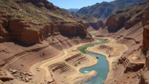
Spotting Erosion Zones Along Riverbanks for High-Yield Pay Dirt
Introduction
Erosion zones along riverbanks represent a critical area for prospectors seeking high-yield pay dirt. Understanding how to identify these zones can greatly enhance the success rate of finding valuable minerals and materials. This article provides a detailed examination of spotting erosion zones, supported by examples and practical insights for both novice and experienced prospectors.
Understanding Erosion Zones
Erosion zones are areas where soil and sediment are removed by the action of water, wind, or other environmental factors. In the context of rivers, this primarily occurs due to the force of flowing water. As the river bends or encounters obstacles, it can undercut riverbanks, leading to erosion. This process can expose underlying layers where valuable deposits may be concentrated.
The Science Behind Erosion
The process of erosion can be likened to how a sculptor carves a statue from a block of marble. Just as a sculptor removes excess material to reveal the desired figure, flowing water gradually removes soil and sediment, revealing what lies beneath. This can lead to the exposure of minerals, gemstones, and other pay dirt.
Types of Erosion
- Hydraulic Erosion: Caused by the direct force of flowing water, often seen in high-velocity streams.
- Corrosive Erosion: Occurs when water chemically alters soils and rock, leading to breakdown.
- Mass Erosion: Involves larger sections of land collapsing due to saturation or destabilization.
Identifying Erosion Zones
Accurately identifying erosion zones is essential for target prospecting. Several indicators can help determine prime locations for extracting high-yield pay dirt.
Visual Cues
Look for the following visual indicators along riverbanks:
- Under Cut Banks: Areas where soil has been washed away from the base of the bank.
- Exposed Roots: Trees whose roots are visible due to soil loss can provide a clue about active erosion.
- Freshly Exposed Rock and Mineral Layers: Newly revealed layers can yield valuable deposits.
Topographic Changes
Changes in the rivers flow pattern or shifts in elevation can indicate erosion. A sharp bend in the river often leads to stronger currents on one side, causing significant erosion and exposing high-quality sediment deposits on the opposite bank.
Real-World Examples
Several case studies illustrate the importance of correctly identifying erosion zones:
Case Study 1: The Yuba River, California
The Yuba River is well-known among prospectors for its gold deposits. In locations where the current has created pronounced erosion zones, diggers have reported finding sizable gold nuggets. Observing undercut banks and the distribution of gravel deposits has yielded promising results.
Case Study 2: The Fraser River, British Columbia
Similar observations in the Fraser River highlight the importance of seasonal changes. During lower water levels, areas once eroded can reveal new gravel beds. So, regular monitoring during different seasons can significantly improve the chances of finding lucrative materials.
Potential Concerns
While prospecting in erosion zones can be lucrative, it is not without risks. There are environmental and legal considerations to keep in mind:
- Environmental Impact: Disturbing erosion zones can lead to further degradation and should be approached with caution.
- Legal Restrictions: Ensure that you are authorized to prospect in the area to avoid legal repercussions.
Actionable Takeaways
For prospectors aiming to find high-yield pay dirt along erosion zones, consider the following strategies:
- Assess riverbank conditions, focusing on undercut areas and shifts in topography.
- Monitor seasonal changes in water levels and sediment exposure.
- Research local regulations regarding prospecting to ensure compliance.
By methodically identifying erosion zones and employing effective prospecting strategies, individuals can enhance their chances of discovering valuable materials and contribute to a sustainable approach to natural resource extraction.


