Techniques for Detecting Under Shallow Layers of Volcanic Ash or Dust
Techniques for Detecting Under Shallow Layers of Volcanic Ash or Dust
Understanding the presence and characteristics of volcanic ash and dust beneath shallow layers is crucial for various fields, including geology, environmental science, and civil engineering. Techniques for detecting these layers can be varied and require an integration of both traditional and modern approaches. This article will explore several effective methods, providing examples and discussing their applications in real-world scenarios.
Sensitive Stratigraphy
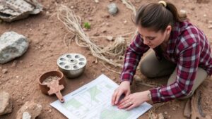
Sensitive stratigraphy involves the detailed analysis of sediment layers to identify volcanic ash deposits that might not be evident at first glance. process begins with careful stratigraphic profiling, which involves:
- Mapping out sediment layers.
- Examining physical properties like grain size and color variations.
- Sampling for laboratory analysis.
An illustrative case study of this technique was undertaken in the Campi Flegrei area in Italy. Researchers used sensitive stratigraphy to trace ash layers beneath soil, revealing a complex volcanic history that had implications for urban planning and disaster preparedness. Their findings highlighted the need for integrating geological assessments in urban infrastructure projects.
Geophysical Techniques
Geophysical techniques such as ground-penetrating radar (GPR) and electrical resistivity tomography (ERT) are valuable for detecting volcanic ash layers without physical excavation. e methods leverage the distinct physical properties of volcanic ash compared to surrounding substrates:
- Ground-Penetrating Radar (GPR): GPR uses radar pulses to image the subsurface. Volcanic ash, with its low density and distinct dielectric properties, can reflect radar waves, revealing its presence.
- Electrical Resistivity Tomography (ERT): ERT measures the electrical resistance of subsurface materials. Volcanic ash typically has higher resistivity compared to wet soils, allowing for the detection of buried ash layers.
For example, a study in the American West used GPR to map volcanic deposits beneath agricultural fields. results indicated significant ash layers that could affect irrigation practices and, ultimately, crop yields. This type of non-invasive assessment allows for better planning and utilization of land resources.
Soil and Air Quality Monitoring
Soil and air quality monitoring serve as indirect methods for detecting imbalances that might suggest underlying volcanic activity or ash. Monitoring involves:
- Analyzing atmospheric particulate matter levels.
- Performing sediment sampling for ash composition analysis.
An illustrative case occurred in the aftermath of the 2010 Eyjafjallajökull eruption in Iceland, where extensive air quality monitoring enabled scientists to track ash dispersion. By analyzing soil samples across various regions, researchers were able to identify unearmarked ash deposits, furthering their understanding of the eruptions broader environmental impact.
Geochemical Analysis
Geochemical analysis is a powerful technique for identifying volcanic materials through elemental and isotopic composition. By applying methods such as X-ray fluorescence (XRF) or inductively coupled plasma mass spectrometry (ICP-MS), scientists can:
- Determine the chemical signature of ash and compare it to known deposits.
- Assess the longevity and preservation conditions of buried ash layers.
A prominent study conducted in the Mediterranean region employed geochemical analysis to trace volcanic activity over millennia. Researchers identified unique geochemical markers within sediment cores, providing insights into both historical eruptions and their subsequent ash dispersal patterns. e findings are pivotal for understanding past volcanic threats and planning for future eruptions.
Remote Sensing Technologies
Remote sensing technologies such as satellite imagery and aerial surveys offer vital tools for identifying the extent of volcanic ash deposits, even those buried beneath soil. Techniques include:
- Using multispectral and hyperspectral imaging to detect ash reflectance.
- Employing LiDAR (Light Detection and Ranging) for topographical mapping and ash thickness assessment.
An example is the use of Landsat satellite images following an eruption in Indonesia, which allowed researchers to map ash cover over large areas and assess potential impacts on agriculture and local waterways. By utilizing remote sensing, scientists can efficiently gather data over vast regions that would be labor-intensive to sample on the ground.
Conclusion
Detecting volcanic ash or dust beneath shallow layers is essential for geological assessments, environmental monitoring, and urban planning. techniques discussed–sensitive stratigraphy, geophysical techniques, soil and air quality monitoring, geochemical analysis, and remote sensing–each have their unique advantages, contributing to a comprehensive understanding of volcanic processes.
By employing a multi-faceted approach that integrates these methods, researchers and practitioners can enhance their ability to detect and analyze volcanic ash layers effectively, thereby improving disaster preparedness and environmental management strategies.
Actionable takeaway: For professionals operating within volcanic regions, it is recommended to combine traditional stratigraphic techniques with modern geophysical and remote sensing technologies to develop a robust understanding of subsurface volcanic ash layers. This comprehensive approach not only aids in managing current risks but also informs future land-use planning and environmental assessments.