Using Modern GIS Tools to Enhance Clues Found on Old Treasure Maps
Using Modern GIS Tools to Enhance Clues Found on Old Treasure Maps
The allure of treasure hunting has captivated adventurers for centuries, often sparked by old maps that reveal enigmatic clues leading to hidden riches. To decipher these aged documents effectively, modern Geographic Information System (GIS) tools have become indispensable. This article explores how GIS technology can enhance our understanding of old treasure maps, making it easier to identify potential treasure locations and contextualize the historical value of these artifacts.
Understanding GIS Technology
Geographic Information Systems (GIS) are advanced tools that combine spatial data, mapping software, and analytical capabilities. Essentially, GIS allows users to view, understand, interpret, and visualize data in a variety of ways, using maps as a primary medium. Modern GIS integrates a range of technologies, including satellite imagery, drones, and data analytics, allowing for comprehensive geographic analysis. According to the Geospatial Intelligence Foundation, the GIS market is projected to grow to $20 billion by 2025, underscoring its importance in various fields, including archaeology and treasure hunting.
Interpreting Old Treasure Maps with GIS
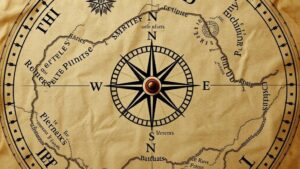
Old treasure maps often contain vague clues, including geographical landmarks, compass roses, and cryptic symbols. GIS tools enhance our ability to decipher these clues through several methods:
- Layering Historical Maps: GIS allows for the superimposition of old maps over current satellite imagery. This technique enables treasure hunters to identify changes in geography and topography over time.
- Georeferencing: By assigning real-world coordinates to old maps, GIS enables the precise location of clues that may have been vague or misinterpreted during their time of creation.
- Spatial Analysis: GIS can analyze the spatial relationships between different landmarks, calculating distances and relationships that may not be immediately obvious.
For example, consider the case of the Oregons Lost Blue Bucket Mine, where adventurers utilized GIS technology to overlay historical mining maps onto modern terrain. By identifying specific features such as ridges and water sources mentioned in old documents, they were able to narrow their search area significantly.
Case Study: The Treasure of Captain Kidd
An illustrative example of GIS applications can be found in the search for Captain Kidds lost treasure. Historical records indicate that Kidd buried treasure on Gardens Island, New York. GIS mapping techniques were employed to analyze historical ship routes, weather patterns, and topography of nearby coastal areas.
Researchers digitized old nautical charts and layered them with modern coastal topographic data. This revealed several locations that closely matched the natural features described in historical accounts, leading to targeted excavation efforts. integration of publically available GIS data and historical records facilitated a deeper understanding of the buried context, suggesting that educational institutions could further enhance scholarly research in this domain.
The Role of Remote Sensing in Treasure Mapping
Remote sensing, another crucial aspect of GIS, has revolutionized treasure hunting by allowing for the collection of data without the need for physical proximity. This technique utilizes aerial photography and satellite images to capture large swathes of territory, revealing hidden features not visible to the naked eye.
For example, the use of LiDAR (Light Detection and Ranging) technology enables researchers to penetrate thick forest canopies and uncover ancient structures or anomalies that could relate to treasure locations. In Belize, archaeologists employed LiDAR to reveal a previously unknown Maya city, directing further exploration efforts and emphasizing the potential of remote sensing in treasure revelation.
Challenges and Limitations
While the use of GIS tools opens new avenues for treasure hunting, several challenges must be acknowledged:
- Data Quality: The accuracy of GIS analysis heavily relies on the availability and quality of data. Old maps may lack the precision necessary for making high-stakes decisions.
- Interpretation Errors: Misinterpretation of both old maps and GIS outputs can lead to misguided expeditions and wasted resources.
- Legal and Ethical Concerns: Treasure hunters must navigate various legal frameworks regarding archaeological sites and historical artifacts to ensure ethical compliance.
A comprehensive understanding and cautious application of GIS tools are essential to mitigate these challenges and enhance treasure hunting experiences.
Actionable Takeaways
For treasure hunters wishing to leverage modern GIS tools, here are several actionable steps:
- Familiarize with GIS software: Platforms such as ArcGIS and QGIS offer user-friendly interfaces for analyzing geographic data.
- Use remote sensing technology: Consider incorporating drone imagery or satellite data to obtain a comprehensive view of target areas.
- Engage in multidisciplinary collaboration: Work with historians, archaeologists, and GIS specialists to enhance the quality of research and interpretation.
As evidenced by technological advancements, GIS tools hold the potential to not only enhance the search for treasures but also to expand our understanding of the historical context surrounding these hidden riches. By utilizing these innovative technologies, treasure hunters can transform old clues into actionable insights, paving the way for remarkable discoveries.


