Mapping Lost Dairy Processing Stations for Rural Agricultural Relics
Mapping Lost Dairy Processing Stations for Rural Agricultural Relics
The agricultural landscape of rural regions is littered with relics of its history, particularly in the dairy processing sector. These stations, once vibrant centers of local economies, have often been abandoned or forgotten. This article delves into the significance of these dairy processing stations, the methodology used to map them, their historical context, and their potential as cultural heritage sites.
The Importance of Dairy Processing Stations
Dairy processing stations played a crucial role in the economic development of rural areas. Between 1930 and 1960, the United States experienced a boom in dairy farms, with the number of dairy cows exceeding 25 million. Each processing station served not only to add value to raw milk but also as a local source of employment and community engagement.
The significance of these stations is illustrated by data from the USDA, which indicate that milk production increased from 44 billion pounds in 1930 to over 120 billion pounds by 1960. This escalation underscores the necessity of processing stations in managing and facilitating this production. In many cases, these stations also contributed to the nutritional needs of local populations through affordable dairy products.
Methodology for Mapping Lost Dairy Processing Stations
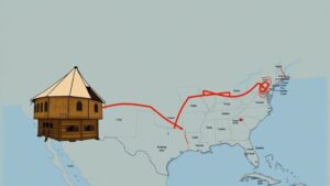
Mapping lost dairy processing stations involves a multi-disciplinary approach that combines historical research, geographic information systems (GIS), and field surveys. This section outlines the steps necessary for effectively documenting these sites.
- Historical Research: This step involves gathering archival data from local historical societies, state agricultural departments, and library collections. Key documents include old maps, photographs, and records that can help identify the locations and operations of these stations.
- GIS Technology: Utilizing GIS enables researchers to visualize historical data spatially. Current mapping tools can overlay historical maps with present-day geocoded data to locate former dairy processing sites accurately.
- Field Surveys: Conducting site visits allows researchers to assess the physical remnants of these stations, such as buildings, machinery, and infrastructure. This also presents an opportunity to conduct interviews with long-time residents who may have firsthand knowledge of these sites.
Case Studies
Several notable case studies exemplify the importance of mapping lost dairy processing stations. For example, in Wisconsin, a state often referred to as America’s Dairyland, over 200 processing facilities have closed since the 1970s, leading to significant rural economic shifts.
In 2015, a collaborative project led by the Wisconsin Historical Society focused on the documentation of these lost sites. Researchers discovered that many processing plants had been repurposed for different uses, while others stood as decaying reminders of past agricultural practices.
- The Greene Dairy Cooperative: Established in 1921, this cooperative was one of the largest in the region. By 1985, it had closed, leaving only remnants that were mapped and documented through the aforementioned collaborative project.
- Sauk County Cheese Factory: In operation from 1950 to 1990, this facility played a vital role in local cheese production. Mapping efforts revealed that the site has since transformed into a community center, demonstrating the potential for adaptive reuse.
Potential for Cultural Heritage and Restoration
The preservation and recognition of former dairy processing stations offer tremendous potential for cultural heritage tourism and educational opportunities. e sites can serve as museums or educational centers, teaching future generations about the evolution of agriculture in rural America.
Also, by integrating these stations into local heritage trails, communities can stimulate economic activity through tourism. According to the National Trust for Historic Preservation, heritage tourism can generate $4 billion annually and create thousands of jobs, benefiting local economies.
Conclusion
Mapping lost dairy processing stations is not merely an academic exercise; it is a vital endeavor that enhances our understanding of rural agricultural history, economic transformation, and community identity. The insights gained from such projects can inform current agricultural practices, promote heritage tourism, and engender a renewed appreciation for local history.
To engage in this meaningful work, actionable steps include:
- Developing partnerships with local historical societies and agricultural organizations.
- Utilizing modern technology, such as GIS, to facilitate efficient mapping.
- Engaging the local community in discussions about the cultural significance of dairy processing stations.
By preserving these relics, societies can cultivate a deeper connection with their agricultural heritage and empower future generations to honor their past.


