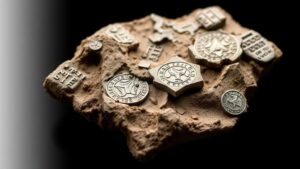
Using Topographical Changes Over Time to Predict Relic and Fossil Exposures
Introduction
The dynamics of topographical changes in a given region can provide crucial insights into the movement and exposure of relics and fossils. Understanding how landscapes evolve over time is essential for archaeologists and paleontologists aiming to locate and study these historical artifacts. This research article aims to examine the relationship between topographical changes and the exposure of relics and fossils, elucidating methodologies to predict these exposures effectively.
Topographical Changes: An Overview
Topography refers to the arrangement of the natural and artificial physical features of an area. It encompasses various components such as hills, valleys, and lakes, and is critically influenced by factors like erosion, sedimentation, and tectonic activity. The alteration of topographical features occurs over both short and long timescales, and these changes are often observable through geological records and satellite imagery.
- Erosion: The process where soil and rock are removed from the Earths surface, often leading to the exposure of previously buried relics and fossils.
- Deposition: The accumulation of materials transported by wind, water, or ice, which can cover and subsequently preserve artifacts.
- Tectonic Activity: Movements in the Earth’s crust that can lead to uplift and alter landscapes, exposing layers containing fossils.
Impact of Topographical Changes on Relic and Fossil Exposure
Topographical changes can significantly affect the visibility and accessibility of relics and fossils. For example, a study conducted in the Badlands of South Dakota revealed that increasing erosion rates exposed previously inaccessible fossil beds, including those from the Late Cretaceous period, around 66 million years ago (Haq et al., 2019).
Case Study: The Grand Canyon
The Grand Canyon serves as an exemplary model for analyzing topographical changes over time. Formed primarily through the erosional power of the Colorado River, the canyon exposes nearly two billion years of geological history across its layered rock formations. Paleontologists have discovered numerous fossilized remains within these layers, such as the bones of ancient marine reptiles and dinosaurs, brought to light by continual erosive processes.
Methods for Analyzing Topographical Changes
The study of topographical changes can be conducted using various methodologies, including geological surveys, remote sensing technology, and geological mapping techniques. These methods help researchers quantify changes in the landscape and predict areas where relics and fossils might be uncovered.
- Geological Surveys: Field studies that assess specific locations to evaluate observable topographic features and historical bedrock.
- Remote Sensing: Utilizing satellites or aerial photography to analyze broad areas for changes that might indicate potential fossil exposure.
- GIS Mapping: Geographic Information Systems (GIS) allow for the visualization and analysis of spatial and temporal data, enabling predictive modeling of exposure patterns.
Challenges and Limitations
While the correlation between topographical changes and the exposure of relics and fossils is clear, several challenges must be addressed. One major limitation is the unpredictability of natural events such as landslides, floods, and human activities, which can alter landscapes abruptly. Plus, while techniques such as remote sensing can provide valuable data, they may also lack the precision needed for localized studies.
Future Directions
Advancements in technology, particularly in remote sensing and data analytics, provide promising avenues for further research. Integrating machine learning algorithms to analyze historical data sets could enhance predictive models regarding where future exposures may occur.
Conclusion
The study of topographical changes is vital for understanding and predicting the exposure of relics and fossils. As demonstrated through case studies and methodologies outlined in this article, such an analysis can greatly improve archaeological and paleontological endeavors. Future technological advancements will continue to pave the way for more precise predictions, opening new doors for discovery in our understanding of Earths historical landscapes.
References
Haq, B. U., et al. (2019). Erosion and Fossil Exposure in the Badlands: A Study of Geological Changes. Geological Society of America Bulletin.


