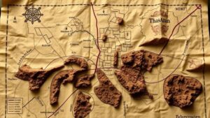
Using Historical Urban Maps to Pinpoint Artifact Hotspots
Using Historical Urban Maps to Pinpoint Artifact Hotspots
The study of artifacts within urban environments has gained significant traction in recent years, particularly through the utilization of historical urban maps. These maps provide invaluable insights into past landscapes, social organization, and economic activity, allowing archaeologists and researchers to identify potential artifact hotspots. By analyzing historical maps, we can enhance our understanding of urban development, human behavior, and material culture.
The Importance of Historical Urban Maps
Historical urban maps serve as a window into the past, offering detailed representations of cities at various points in time. r significance lies in several aspects:
- Temporal Context: They provide a chronological framework for understanding urban changes.
- Spatial Relationships: By illustrating street layouts, buildings, and property boundaries, these maps help identify areas of activity.
- Resource Management: They reveal historical resource distribution, including water sources, trade routes, and agricultural fields.
- Cultural Insights: Maps reflect societal values, including zoning laws and community organization.
For example, the use of Sanborn Fire Insurance Maps in the United States from the late 19th and early 20th centuries allows researchers to analyze urban growth, fire hazards, and the density of buildings over time, leading to better archaeological predictions.
Mapping Techniques and Technologies
Today, the integration of Geographic Information Systems (GIS) technology with historical map data has revolutionized the field of urban archaeology. GIS enables researchers to layer historical maps with contemporary data, allowing for more nuanced spatial analyses. These techniques can reveal patterning in artifact distribution and help in predicting areas rich in archaeological potential.
For example, the overlay of historical property ownership maps with modern city layouts can identify neighborhoods that have experienced little disturbance, thus increasing the likelihood of artifact preservation. Also, remote sensing technologies can survey sites effectively, further refining the search for hotspots.
Case Studies of Successful Applications
Numerous case studies exist that illustrate the successful application of historical maps in identifying artifact hotspots:
- Londons Archaeological Revolution: In London, archaeologists utilized 17th-century maps to pinpoint areas around the River Thames, leading to the discovery of several shipwrecks and trade goods.
- Baltimores Urban Landscape: The study of 19th-century maps revealed the locations of past markets which were previously unknown, resulting in important excavations around these areas.
- Rural vs. Urban Contexts: In rural settings like colonial Virginia, researchers used historical plantation maps to focus excavations on expected areas of human activity, uncovering significant artifacts related to daily life.
Challenges and Considerations
While the benefits of using historical urban maps are clear, several challenges must be addressed:
- Map Accuracy: Historical maps may contain inaccuracies or biases introduced by their creators, affecting interpretations.
- Data Integration: Combining different data sources can be complex, requiring careful calibration and analysis.
- Community Impact: Archaeological activities can disrupt modern communities, necessitating an ethical approach.
Researchers must remain cognizant of these concerns, ensuring that findings respect both historical context and present-day considerations. Engaging with local communities can also provide insights that enhance the archaeological process.
Actionable Takeaways
Utilizing historical urban maps to identify artifact hotspots is a multifaceted approach that requires a blend of traditional methodologies and modern technology. For individuals looking to implement these strategies, consider the following actionable steps:
- Research Historical Maps: Investigate archived maps relevant to your study area, focusing on changes over time.
- Leverage GIS Tools: Familiarize yourself with GIS software to analyze spatial relationships effectively.
- Conduct Field Surveys: Engage in field surveys to corroborate findings and ground-truth potential hotspots.
- Collaborate with Communities: Work with local historians and communities to gain deeper context and garner support.
To wrap up, the intersection of historical urban maps and archaeology opens new avenues for understanding past human behavior and artifact distribution. By embracing these methodologies, researchers can enrich their findings and contribute valuable knowledge to the broader narrative of urban history.


