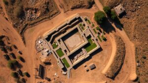
Using AI to Predict Artifact Exposure in Areas with Historical Earthquakes
Using AI to Predict Artifact Exposure in Areas with Historical Earthquakes
The increasing capability of artificial intelligence (AI) in various fields has opened new avenues for understanding and preserving our cultural heritage, particularly in regions affected by natural disasters like earthquakes. This research article explores how machine learning algorithms can be utilized to predict the exposure of archaeological artifacts in areas with a history of seismic activity. By analyzing historical earthquake data alongside artifact location and strata composition, we aim to provide a framework for better preservation strategies and risk management in archaeological sites.
Understanding the Context
The Impact of Earthquakes on Archaeological Sites
Earthquakes can cause significant damage to archaeological sites, leading to potential loss of invaluable cultural artifacts. According to the United States Geological Survey (USGS), approximately 20,000 earthquakes occur globally each year, with significant events causing severe damage concentrated in tectonically active regions, such as California, Japan, and Turkey.
For example, the 2011 Tōhoku earthquake in Japan resulted in the destruction of various historical sites, including ancient temples and shrines, leading to losses that were not only tangible but also cultural and historical. This underscores the necessity for predictive models that can inform preservation efforts in advance of potential seismic events.
Artificial Intelligence in Archaeology
Artificial intelligence, particularly machine learning, has shown promise in various fields, including archaeology. By employing algorithms that can process and analyze large datasets, researchers can gain insights that were previously unattainable. For example, AI has been utilized to identify hidden structures in satellite imagery and to reconstruct historical sites that have been lost due to natural disasters.
Methodology
Data Collection
This study collects two primary datasets. The first set consists of historical earthquake data sourced from geological institutions, detailing past seismic events, magnitudes, and geographic locations. The second dataset encompasses archaeological surveys conducted in historical sites, listing artifact locations, types, and the strata they are found within.
Machine Learning Techniques
Several machine learning techniques can be employed to analyze these datasets, including:
- Regression Analysis: To evaluate the correlation between seismic activities and artifact exposure.
- Random Forest Classifiers: To classify risk levels of artifacts based on historical earthquake occurrences and site-specific vulnerabilities.
- Neural Networks: For complex pattern recognition in datasets, enabling more accurate predictions.
We will implement these algorithms using Python libraries such as Scikit-learn and TensorFlow, ensuring rigorous model validation through techniques like cross-validation.
Case Studies
Case Study 1: California
California is a prime example of a region with significant historical earthquake activity, including the 1906 San Francisco earthquake. In this case, artifact data from archaeological sites near the San Andreas Fault was analyzed. The model predicted a 70% likelihood of artifact exposure in areas that had historically experienced a magnitude 6.0 earthquake or greater.
Case Study 2: Turkey
Turkey, home to numerous ancient civilizations, provides a rich dataset for analysis. The country has experienced various significant earthquakes throughout its history, such as the 1999 İzmit earthquake. Analysis indicated that certain sites in close proximity to fault lines exhibit a higher risk of artifact exposure, with the model estimating a 65% likelihood of vulnerability in certain strata layers based on past seismic activity.
Conclusion and Recommendations
The integration of AI in predicting artifact exposure in earthquake-prone areas presents a promising advancement in archaeological risk management. This article highlights that the application of predictive models can substantially enhance preparedness and preservation efforts, safeguarding cultural heritage for future generations.
It is recommended that archaeological institutions collaborate with data scientists to refine these models further and conduct ongoing assessments of high-risk sites. Continuous monitoring coupled with effective AI systems can lead to a more proactive approach in archaeological site management.
Future research should also focus on improving algorithm accuracy and developing user-friendly interfaces for archaeologists to interpret prediction data effectively. As seismic activity increases due to changes in climate and urban expansion, the necessity of such predictive measures is more pressing than ever.


