Techniques for Identifying Sunken Relics in Flooded River Canyons
Techniques for Identifying Sunken Relics in Flooded River Canyons
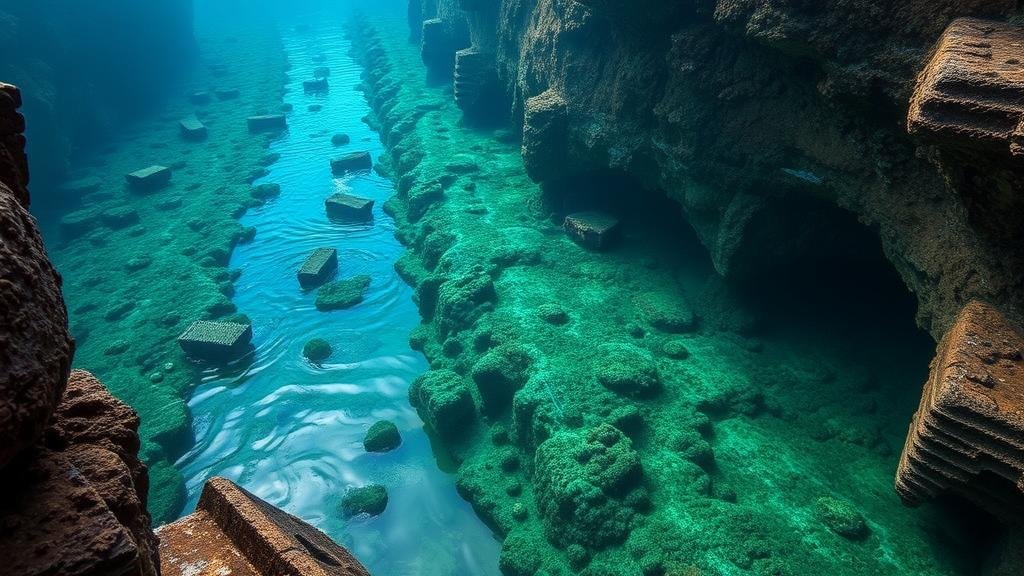
Flooded river canyons present unique challenges and opportunities for archaeologists and treasure hunters alike. The submerged territory serves as a time capsule, encapsulating a wealth of historical artifacts and relics that can yield insights into past civilizations. This article will explore various techniques used to identify and locate sunken relics, utilizing a combination of technological advancements and traditional archaeological methods.
1. Remote Sensing Technologies
Remote sensing technologies have revolutionized the way underwater archaeology is conducted. These techniques allow researchers to survey extensive areas without the need for immediate physical deployment. Two widely used methods are sonar imaging and aerial remote sensing.
- Sonar Imaging: This technology utilizes sound waves to create detailed images of the underwater landscape. Multi-beam sonar provides a three-dimensional map, revealing both the terrain and any objects resting on the riverbed. A notable example is the use of sonar during the exploration of Lake Michigan, where shipwrecks were located in areas previously thought to be barren.
- Aerial Remote Sensing: Techniques such as LiDAR (Light Detection and Ranging) can penetrate water, allowing for the identification of submerged structures. These images, combined with historical maps, help guide underwater explorations in river canyons that hold potential sunken relics.
2. Magnetometry
Magnetometry is another effective technique for locating sunken relics, particularly metallic objects. This method involves measuring variations in the Earths magnetic field, which can indicate the presence of submerged metals.
The application of magnetometry has proven successful in river canyons, where sediment and water cover potential relic sites. For example, during the investigation of submerged World War II vessels in the Seine River, magnetometers successfully located several shipwrecks by detecting the metal components still intact in the underwater environment.
3. Diver Surveys and ROVs (Remotely Operated Vehicles)
While technology plays a significant role in initial assessments, diver surveys and ROVs are invaluable for detailed examinations. This combination allows for a thorough investigation of discovered relics.
- Diver Surveys: Experienced scuba divers can visually inspect and document discoveries, providing context and condition assessments of relics found during preliminary surveys. For example, divers in the Grand Canyon have accessed submerged indigenous artifacts, contributing to a deeper understanding of local history and culture.
- Remotely Operated Vehicles: ROVs equipped with cameras and sampling tools are deployed for areas where diving is impossible due to hazards or depth. e vehicles can navigate complex river canyon systems, capturing high-definition video footage that can be analyzed to identify archaeological sites accurately.
4. Historical Research and Community Collaboration
No advanced technology can replace the inherent value of historical documentation and community knowledge. Understanding past flood events and human activities in the region can provide context vital for effective exploration.
- Historical Maps and Records: Researchers often refer to maps that detail the river’s historical changes due to flooding or human alteration. e documents enable a targeted search for relics in previously thriving areas now submerged.
- Community Insights: Engaging local communities can yield invaluable oral histories or tips about potential relic locations. In many instances, residents have recalled specific stories tied to the river’s past that lead to significant discoveries.
5. Environmental DNA (eDNA) Analysis
A more recent innovation in archaeological methodologies involves the analysis of environmental DNA (eDNA) extracted from sediment. This process identifies genetic material from organisms that once inhabited the area, which can indirectly point to human activities and artifacts.
For example, eDNA studies in flood-prone areas have uncovered clues about ecosystems that existed alongside ancient civilizations, leading researchers to explore and excavate areas of interest. This technique can also be a subtle yet powerful tool in guiding traditional excavation efforts.
Conclusion
The search for sunken relics in flooded river canyons involves a multidisciplinary approach, integrating advanced technologies, traditional archaeological practices, and community engagement. By harnessing tools like sonar imaging, magnetometry, and ROVs, researchers can enhance the identification and recovery of historical artifacts. Also, applying eDNA analysis can refine the search process further, uncovering insights that inform future explorations. As technology continues to evolve, the field of underwater archaeology will undoubtedly unravel new layers of history that remain hidden beneath the waters of river canyons.


