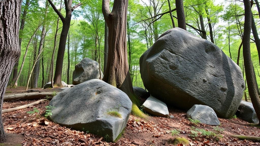
Identifying Trees and Boulders Used as Markers on Hidden Trail Maps
Identifying Trees and Boulders Used as Markers on Hidden Trail Maps
Trail mapping is an essential skill for hikers, outdoor enthusiasts, and those who navigate through natural landscapes. Within this domain, identifying trees and boulders as markers on hidden trail maps can significantly enhance navigation efficiency and accuracy. This article delves into the nuances of identifying such markers and their significance in trail mapping.
The Importance of Natural Markers
Natural markers, including distinctive trees and boulders, play a critical role in navigation. serve as reference points that can make or break a journey through unfamiliar terrain. For example, experienced hikers often mention that they utilize specific tree species or uniquely shaped boulders as navigational aids to confirm their location and maintain their bearings.
- Tree Markers: Trees like the Eastern White Pine or Black Oak can be easily recognized by their unique bark textures or leaf shapes.
- Boulder Markers: Large, flat boulders that stand out in a landscape can provide visual landmarks, especially in areas where the vegetation is sparse.
Identifying Trees as Trail Markers
In many cases, trees are fundamental markers used on hidden trail maps. Identification involves recognizing specific characteristics that distinguish one species from another. Factors to consider include:
- Bark Texture: The texture of the bark can be smooth, rough, scaly, or curly, varying significantly among species.
- Leaf Shape: Trees have distinct leaf shapes, such as lobed, needle-like, or broadleaf varieties. For example, the Maple tree is known for its lobed leaves.
- Growth Patterns: Some trees grow in unique patterns–consider the weeping branches of a Weeping Willow.
Consider the case of the Appalachian Trail, where hikers often rely on the distinctive leaves of the White Oak to mark their route. The broad, rounded leaves can make a noticeable visual guide in a wood-dense area.
Identifying Boulders as Trail Markers
Boulders, due to their size and form, are equally useful as navigational aids. When identifying boulders as markers, several attributes should be evaluated:
- Shape and Size: Boulders can be angular, rounded, or flat. Notable shapes can offer distinct landmarks, such as the Duck Rock on the Pacific Crest Trail.
- Color: The coloration of a boulder can also be a useful identifier. For example, granite boulders often display distinctive gray or pink hues.
- Location: Boulders situated near water sources or on prominent ridges can serve reliable markers for trail orientation.
An example of effective boulder usage in navigation can be seen along the John Muir Trail, where specific boulders have been named and are referenced in guides and maps.
Case Studies in Trail Navigation
To understand the practical application of identifying these natural markers, we can examine two notable case studies: the Pacific Crest Trail and the Appalachian Trail.
Pacific Crest Trail
Along this long-distance hiking trail that stretches from Mexico to Canada, navigators often refer to prominent trees and boulders as essential markers. Trails designation requires hikers to be aware of these natural references, with detailed maps indicating key species such as the Sugar Pine or specific granite boulders known for their defining features. Accurate identification aids in maintaining path integrity and avoiding common navigational pitfalls.
Appalachian Trail
The Appalachian Trail provides a rich tapestry of unique trees and massive boulders. In this region, hikers are trained to differentiate between similar tree species, such as the Chestnut Oak and the Northern Red Oak, which can significantly impact navigation decisions. Also, hikers rely on well-known boulders to assess their position along the winding routes of the trail.
Practical Tips for Using Natural Markers
When navigating with trees and boulders, outdoor enthusiasts can employ the following strategies:
- Familiarize Yourself: Spend time understanding the native flora and geological features of the region before heading out.
- Use Visual Guides: Reference field guides or mobile applications that provide photos and descriptions of local tree and boulder species.
- Leverage GPS Technology: Use GPS devices in conjunction with natural markers for added assurance in navigation.
Conclusion
Understanding the identification of trees and boulders as markers on hidden trail maps enhances navigating skills in outdoor settings. By becoming acquainted with the unique attributes of various species and geological formations, hikers can confidently traverse trails, reducing the risk of getting lost. Also, utilizing natural markers fosters a deeper connection with the environment, advancing outdoor skills and improving the overall hiking experience.
In summary, effective trail navigation relies heavily on recognizing and utilizing trees and boulders as natural markers. As outdoor enthusiasts deepen their knowledge in this area, they can enhance their capabilities and enjoy the great outdoors with greater assurance and appreciation.


