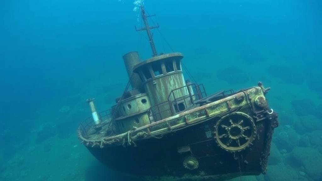
Accessing NOAA Marine Sanctuary Data to Locate Unexplored Shipwrecks
Accessing NOAA Marine Sanctuary Data to Locate Unexplored Shipwrecks
The National Oceanic and Atmospheric Administration (NOAA) manages a network of marine sanctuaries that serve as both conservation areas and research platforms. One critical application of data from these sanctuaries is the identification and exploration of shipwrecks, particularly those that remain unexplored. This article investigates how to access NOAA marine sanctuary data for shipwreck identification, emphasizing the relevance of this inquiry due to the historical and archaeological significance of these underwater sites.
Understanding NOAA Marine Sanctuaries
NOAAs National Marine Sanctuary System was established in 1972 under the National Marine Sanctuaries Act, designed to protect areas of the marine environment with special national significance. Currently, there are 15 marine sanctuaries across the United States, comprising diverse ecosystems ranging from coral reefs to underwater canyons. These sanctuaries serve as repositories of information related to marine biodiversity, historical resources, and human history, particularly concerning maritime activities.
Accessing NOAA Data
Accessing NOAA marine sanctuary data is pivotal for researchers and maritime archaeologists interested in locating unexplored shipwrecks. The data can be accessed through a variety of online platforms and databases maintained by NOAA. Key resources include:
- NOAA National Centers for Environmental Information (NCEI): This center provides extensive datasets that include historical maritime records.
- National Marine Sanctuary Program (NMSP): Specific information about sanctuaries, including shipwreck sightings, conditions, and protected historical sites can be found here.
- Marine Protected Areas (MPA) Inventory: This resource offers information on various protected areas, including unresolved shipwreck sites.
For example, the Monitor National Marine Sanctuary off the coast of North Carolina is renowned for the sinking of the USS Monitor, yet it hosts many unexplored wrecks that can be identified through extensive data analysis of depth, currents, and historical shipping routes.
Utilizing Geographic Information Systems (GIS)
Geographic Information Systems (GIS) are critical tools for mapping and analyzing data related to shipwrecks. GIS technology allows researchers to overlay various datasets, including bathymetric maps, archaeological surveys, and historical shipping lanes, to identify potential shipwreck sites.
An illustrative case is the application of GIS in the Channel Islands National Marine Sanctuary. Researchers employed GIS mapping to combine NOAA marine data with historical records, resulting in the discovery of several unidentified shipwrecks dating back to the 19th century.
Challenges in Locating Unexplored Shipwrecks
Despite the availability of rich datasets, several challenges persist in the quest to locate unexplored shipwrecks:
- Data Limitations: Existing NOAA datasets may not cover all historical shipwrecks, particularly those that were not reported or are situated in less frequented areas.
- Environmental Factors: Marine environments are dynamic and subject to change, affecting the visibility and accessibility of underwater sites.
- Technological Barriers: Limited access to advanced underwater exploration technologies, such as remotely operated vehicles (ROVs), can hinder the surveying of remote areas.
Real-World Applications
Research and findings derived from accessing NOAA marine sanctuary data have practical applications in various fields:
- Maritime Archaeology: The exploration of shipwrecks leads to uncovering historical maritime trade routes and understanding past human behavior.
- Conservation Efforts: Identifying shipwreck sites aids in the implementation of conservation measures, preserving both biological ecosystems and archaeological integrity.
- Tourism Development: Shipwreck diving tours provide economic opportunities for coastal communities, combining adventure with historic education.
Actionable Takeaways
Researchers and maritime archaeologists can enhance their shipwreck exploration efforts by:
- Utilizing NOAA’s extensive databases for initial research on potential shipwreck locations.
- Integrating GIS technology to conduct comprehensive site analyses.
- Collaborating with NOAA and local universities for access to advanced marine exploration tools.
To wrap up, accessing NOAA marine sanctuary data is vital for the identification of unexplored shipwrecks. This knowledge enriches our understanding of maritime history and underscores the importance of protecting these underwater cultural heritage sites.

